Advanced sonar joins MH370 hunt

The search for Malaysia Airlines Flight MH370 enters a new underwater phase this week with two specialist ships joining to locate the jetliner almost seven months after it disappeared.
Flight MH370 went missing en route from Kuala Lumpur to Beijing on March 8 with 239 people onboard. No trace of the Boeing 777-200 has been found despite a massive air, sea and underwater search.
Authorities have since used technical data to focus the search in the southern Indian Ocean to the west of Western Australia, along a thin, long arc from which the plane emitted its last satellite "handshake".
Australia has been spearheading the hunt for the plane, which is believed to have come down after mysteriously diverting off-course, leaving search teams with a daunting task that has been beset by false leads and initial confusion - to the continued frustration of grieving relatives.
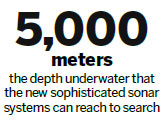
The latest phase to begin in early in October will see two ships - Fugro Discovery and the Malaysian-contracted GO Phoenix - send sophisticated sonar systems about 5,000 meters below sea level to search the ocean floor using sound waves, the Australian Transport Safety Bureau said.
'Cautiously optimistic'
The systems, attached to the ships by tow cables up to 10 km long, have been programmed to detect the biggest parts of the aircraft that are likely to be in one piece, such as engines, landing gear and fuselage, the ATSB's Peter Foley said.
If "abnormalities" are detected, the ships will return to those areas and pilot the vehicles "slower and lower", using cameras to look at the seabed, said Foley, who is in charge of search operations.
Foley said he was "cautiously optimistic" the underwater probe will be successful, but he acknowledged the "very challenging" conditions faced by the search teams at the remote and largely unexplored location.
On the surface, the ships and their crew operate in cold, windy conditions and on rough seas with waves as high as 12 meters.
Underwater, the searchers are discovering new features in a varied terrain previously mapped with coarser resolution using limited satellite data.
"Given the area that we are going to need to potentially search, it's an extraordinary challenge," Foley said.
(China Daily 09/30/2014 page11)


