|
Up to 3,000 feared dead in Philippines landslide
(AFP/Xinhua)
Updated: 2006-02-18 14:44 Several relatives told the station they had received short text messages from
the missing villagers as late as early Saturday, appealing for help.
Lim said rescuers resumed their search at first light Saturday morning,
having suspended efforts when darkness fell on the village more than 400 miles
(675 kilometers) southeast of Manila.

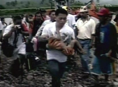
A small child is carried from a landslide on
Leyte island in the eastern Philippines Friday, Feb. 17, 2006. A
rain-soaked mountainside disintegrated into a torrent of mud on Friday,
burying hundreds of houses and an elementary school in the eastern
Philippines. Ten people were confirmed dead, and at least 1,500 were
missing. [AP] | Several hundred residents of 11
surrounding hamlets have been moved to higher ground, many of them into Saint
Bernard, "for fear that more slides might occur," the civil defense office in
Manila said in a statement.
Experts say the area's geology, heavy rainfall and deforestation may all have
contributed to the tragedy.
Leyte island, which sits on a geological fault, features narrow, flat coastal
areas and a mountainous interior and is prone to landslides.
Defense Secretary Avelino Cruz said 500 millimeters (20 inches) of rain had
fallen in the area since February 1, nearly five times the average for the
month, due to the cyclical weather phenomenon called La Nina in the Pacific
Ocean.
More than 5,000 people were killed in a combined flood and mudslide in the
Leyte city of Ormoc in November 1991.
Southern Leyte province governor Rosette Lerias said the last census showed
there were 375 houses with 3,000 people living in Guinsaugon before the
landslide.
"It was like mud running down the mountain and it covered the village in
seconds," she said, quoting survivors.
Lerias said many Guinsaugon residents had evacuated after landslides earlier
in the week had killed more than 20 people in the nearby town of Sogod, but many
had returned Friday because the rain had stopped and the sun had come out.
Television footage of the disaster scene showed a flat expanse of brown earth
spread over several hectares (acres) between rice paddies and the steep flank of
Mount Can-abag, one side of which has been shorn of all vegetation.
Only crumpled tin roofing and the tops of some coconut palms were visible
from the mud, estimated to be at least six meters (20 feet) deep. Among the
buried structures was a school with 206 students and 41 teachers who are among
the missing.
The air force was set to airlift rescue teams and relief supplies to the area
on Saturday.
Army troops and volunteer rescue teams are involved in the search and rescue
efforts, while the US Navy diverted one of its vessels involved in annual war
games with Manila to the disaster zone.
The Red Cross in Geneva appealed for two million Swiss francs (1.52 million
dollars) to fund a relief operation.
The United Nations deployed a special team to assess the disaster as
Secretary General Kofi Annan expressed sadness at the huge loss of life.
A mild 2.6-magnitude earthquake which struck before the landslide may have
helped trigger the landslide, said Rene Solidum, head of the government
volcanology office.
|