 |
1. Functions: a pioneer area of urban and rural integration, a modern comprehensive functional area, an exemplary area of opening-up, an important national industrial base for new energies, and a transportation hub and logistics center among Henan, Shaanxi and Hubei.
2. Location: Nanyang New District is a central area in Nanyang. In the north, it borders on the trunk canal of the South-to-North Water Diversion Project, the Lihe township is to the south, the Baihe River to the northwest, and the Xuchang-Pingdingshan-Xunan Highway is to the east. It covers urban land, rural land and ecological land with the planning area of 192 square kilometers.
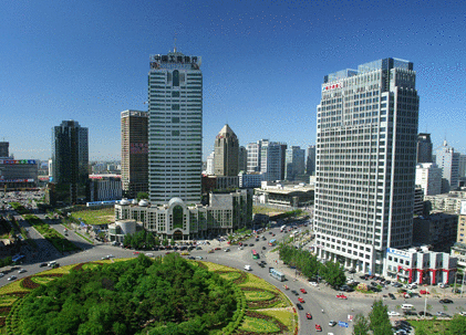
3. Layout: The new district's layout features "one pole, two wings and multiple groups". "One pole" mainly refers to the central business district and the central cultural and living district (i.e. Park A). It functions as a site for conferences and exhibitions, cultural expositions, business, finance, as well as for residential and commercial activities. The district and the government affairs center at the west bank of Baihe River constitute a compound center and is an iconic area of the city. "Two wings" mainly refers to the two major clusters of development in the north and south. The north one aims to build an important regional platform for recreation and innovation relying on the high-speed transportation terminal; the south one aims to be a regional logistics center depending on the railway freight station and two highway exits in the south. "Multiple groups" include residential and professional industrial groups like the logistics group, reception group, etc.
4. Ecological landscape: The new district's ecological landscape features "one river, seven corridors, four axes and one belt". "One river" refers to the Baihe River and the scenic wetland belt along it; "seven corridors" refers to the seven ecologically controlled corridors, including the highway ecological corridor, Dushan Mountain ecological corridor, Xizhao River ecological corridor, northern airport ecological corridor, Baitong canal ecological corridor, Shanghai-Shaanxi Highway ecological corridor, and the Erenhot-Guangzhou Highway ecological corridor; "four axes" refers to the four main avenues, including Dushan Mountain scenic axis, Guangwu landscape avenue, Zhongjing landscape avenue, and Huanghe landscape avenue; "one belt" refers to the urban public service belt comprised of several places along the Baihe River banks.
5. Scales: By 2015, the population in the district will reach 400,000, with a land construction area up to 40 square kilometers; by 2020, the population will reach 700,000, with a land construction area up to 70 square kilometers; by 2030, the population will reach 1.2 million, with a land construction area up to 120 square kilometers.
6. Goals: The general planning is to "lay the foundation in the first year, form a good image in three years, and achieve a large scale in five years".
Short-term (2011-2015) goals: focus on transportation infrastructure, education, exhibitions and logistics to establish an administrative center and a new urban community.
Medium-term (2016-2020) goals: establish a logistics park, an exhibition park, an education park covering from preschool education to higher education, a research and development area, and an administrative center; build the Nanyang high-speed railway station.
Long-term (2021-2030) goals: establish Nanyang's new urban area; fulfill the goals set by the provincial party committee and the government, that is, to become a strategic hub in the central and western regions of China and a regional central city that connects with Henan, Shaanxi and Hubei.