|
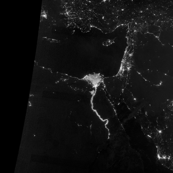
A NASA Earth Observatory image released Dec 5, 2012 shows the area near the Nile River valley and delta on the night of Oct 13, 2012. The image was acquired by the Visible Infrared Imaging Radiometer Suite (VIIRS) on the Suomi NPP satellite. The image is based on data collected by the VIIRS "day-night band," which detects light in a range of wavelengths from green to near-infrared and uses filtering techniques to observe signals such as gas flares, auroras, wildfires, city lights, and reflected moonlight. The image has been brightened to make the city lights easier to distinguish. This image was acquired near the time of the new Moon, and little moonlight was available to brighten land and water surfaces. [Photo/Agencies]
|

 Relief reaches isolated village
 Rainfall poses new threats to quake-hit region
 Funerals begin for Boston bombing victims
 Quake takeaway from China's Air Force
 Obama celebrates young inventors at science fair
 Earth Day marked around the world
 Volunteer team helping students find sense of normalcy
 Ethnic groups quick to join rescue efforts


