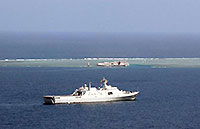
US and Japan conduct drill
By Cai Hong in Tokyo and Zhou Wa in Beijing (China Daily) Updated: 2013-01-16 00:23The first stage of the island surveying and mapping was launched in 2009 and has finished the monitoring of islands located within 100 km of the coastline, according to a document issued at a news conference by the National Administration of Surveying, Mapping and Geoinformation.
The second stage will cover islands including the Diaoyu Islands, the document said.
It added that this program is part of the country's efforts to safeguard its maritime rights and interests.
By the end of last year, China had completed the identifying and precise positioning of about 6,400 islands and more than 4,900 island maps of three scales.
Contact the writers at caihong@chinadaily.com.cn and zhouwa@chinadaily.com.cn
Xinhua contributed to this story.


