Height of Mount Qomolangma to be measured by expedition
By Palden Nyima in Lhasa, Tibet | chinadaily.com.cn | Updated: 2020-04-30 21:20


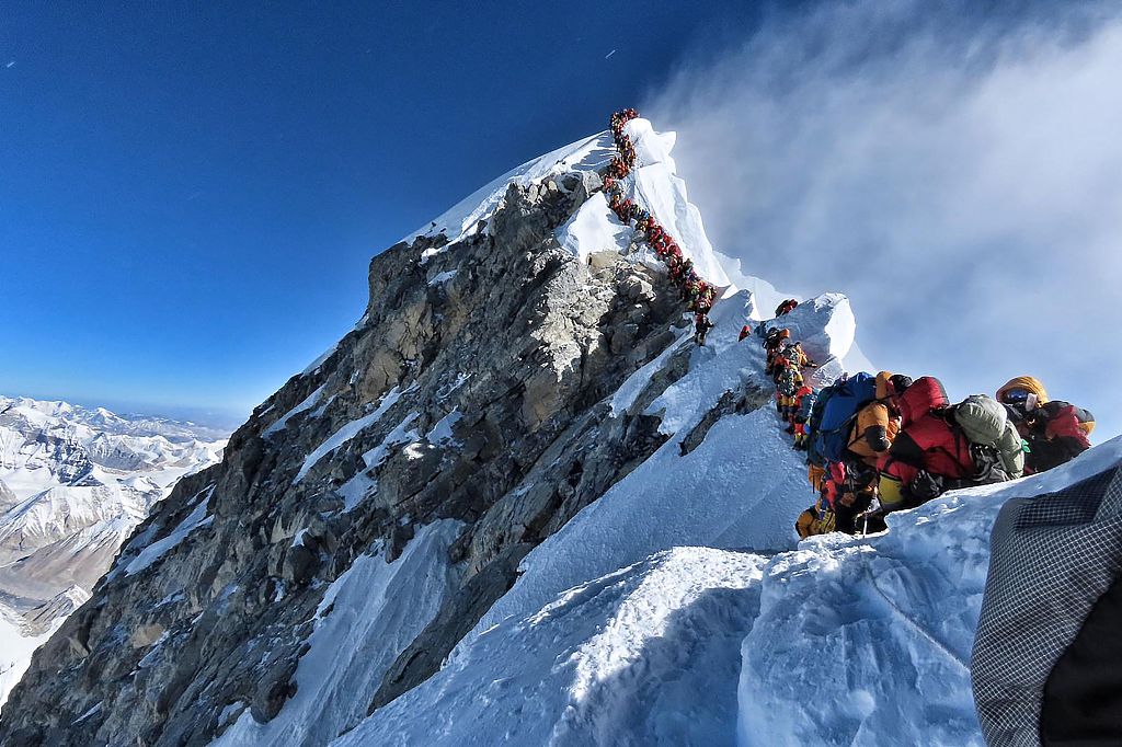
China has launched a campaign to measure the height of Mount Qomolangma, which is known in the West as Mount Everest, the Ministry of Natural Resources announced on Thursday.
The remeasurement of the peak's height is a part of China's latest large-scale comprehensive scientific survey of Qomolangma, and the project is jointly organized by the Ministry of Natural Resources, the Ministry of Foreign Affairs, the General Administration of Sports of China, and the regional government of the Tibet autonomous region.
The 1st Geodetic Surveying Brigade under the Ministry of Natural Resources and the China Mountaineering Team are the two parties carrying out the project.
Currently, the team is under acclimatization and high-altitude surveying skills training, and they are expected to conduct the project in May.
Preparation of the project was initiated in early March, with 53 surveyors from the 1st Geodetic Surveying Brigade getting stationed near Qomolangma to carry out adaptive climbing and training in other technical skills, and they are going to the survey on the summit of the mountain.
To ensure the accuracy of the measurement, and to work it in a more scientific way, experts from the Chinese Academy of Surveying and Mapping, the Shaanxi Bureau of Surveying, Mapping and Geoinfomrmation, and the China Geological Survey were invited to assist in the technical design and planning of the project from the beginning.
The technical innovation and breakthrough applied in the latest survey include the application of the BeiDou-3 Navigation Satellite System and advanced domestic surveying and mapping instruments.
Enriched with many high peaks, including Mount Qomolangma, Southwest China's Tibet has long been considered as a heaven for climbers from all over the world.
This spring, the region suspended climbing services for foreign climbing expedition teams, due to the COVID-19 pandemic.
This year marks the 60th anniversary of the first successful expedition to Mount Qomolangma, and the 45th anniversary of China's first accurate measurement of Qomolangma's height.
The Chinese government has conducted six large-scale surveys and measurements on Qomolangma in the past few decades; it had successfully measured and announced the height the mountain in 1975 and 2005, respectively.
Chinese mountaineers and researchers climbed Mount Qomolangma in 1975 to determine its height afresh and concluded that the rock height of the peak was about 8,848.13 meters, and in 2005, the summit was measure at 8,844.43 meters (29,017 feet).